Parent Directory
Parent Directory
Parent Directory
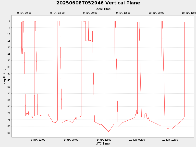
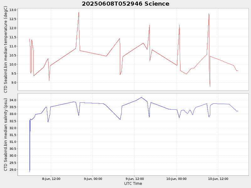
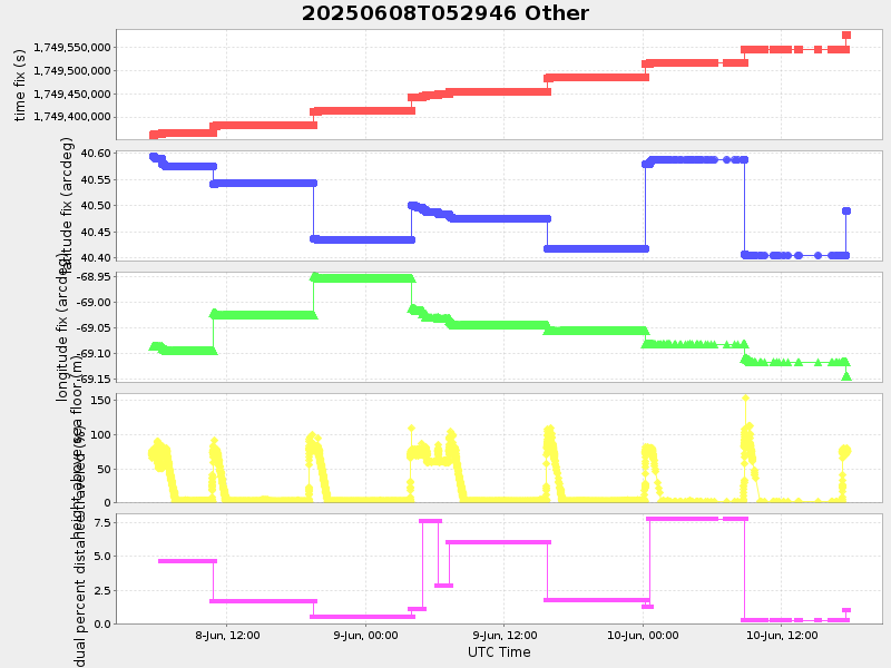
| Start time | End time | Last Latitude & Longitude |
Current (1hr avg) |
|---|---|---|---|
| 2025/06/08 05:30:00 GMT 2025/06/07 22:30:00 local |
2025/06/10 17:41:14 GMT 2025/06/10 10:41:14 local |
40.48964541339198 -69.14551419200235 |
37.37458510289348 Amp |
| Downloads: | ||||
| shore.nc shore.mat |
shore.kml shore.kmz |
shore.asc shore.dir |
shore.csv shore.log |
argos_24hr.kml argos_week.kml, argos_month.kml |
| Elapsed time since start: ... | Elapsed time since last valid data: ... |