Parent Directory
Parent Directory
Parent Directory
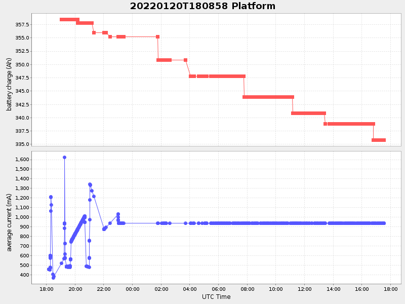
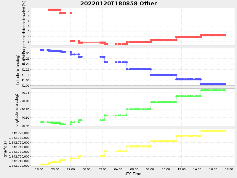
| Start time | End time | Last Latitude & Longitude |
Current (1hr avg) |
|---|---|---|---|
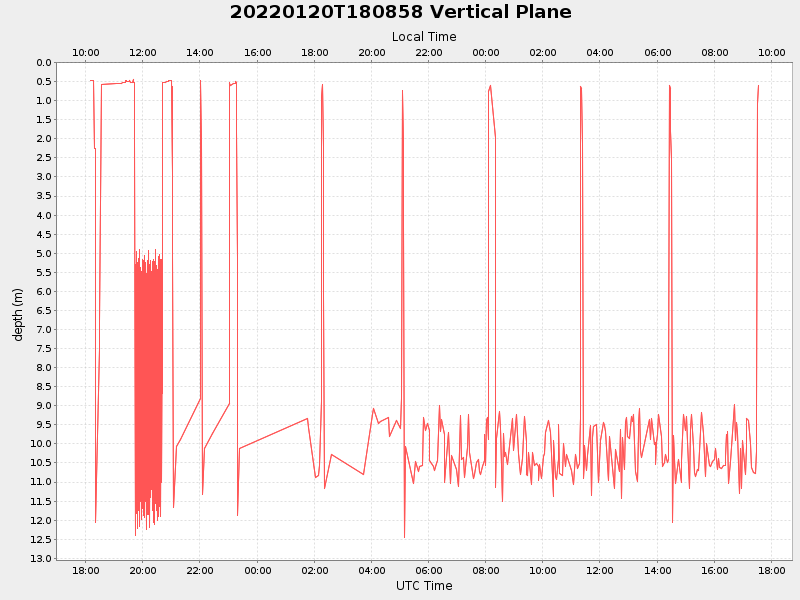
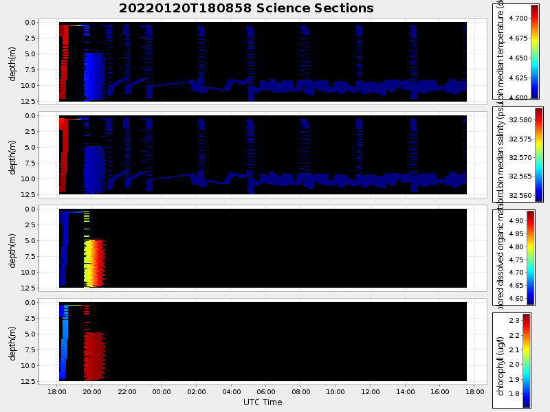
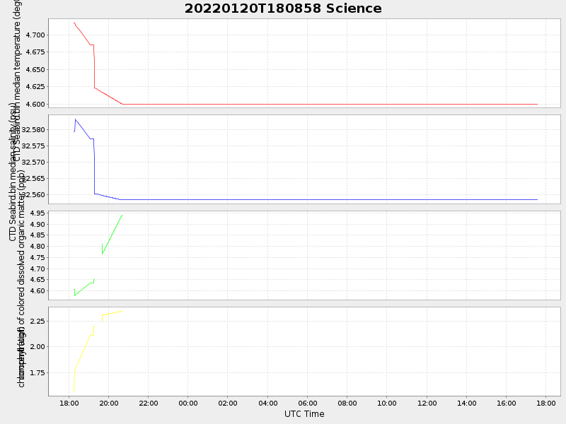
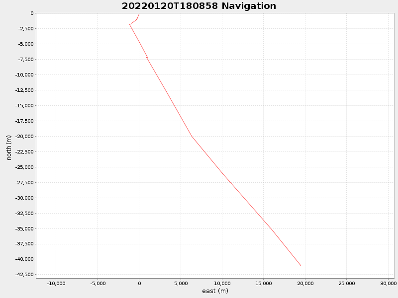
| 2022/01/20 18:10:07 GMT 2022/01/20 10:10:07 local |
2022/01/21 17:33:03 GMT 2022/01/21 09:33:03 local |
40.96260366256453 -70.69447572693866 |
2.9368170451380684 Amp |
| Downloads: | ||||
| shore.nc shore.mat |
shore.kml shore.kmz |
shore.asc shore.dir |
shore.csv shore.log |
argos_24hr.kml argos_week.kml, argos_month.kml |
| Elapsed time since start: ... | Elapsed time since last valid data: ... |